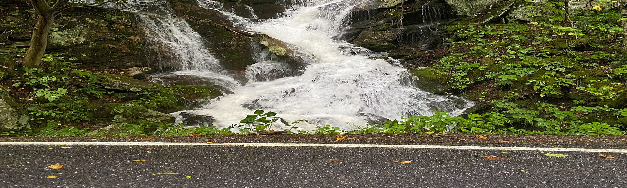
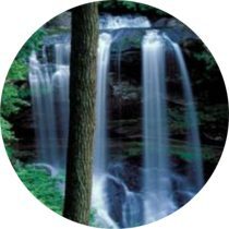
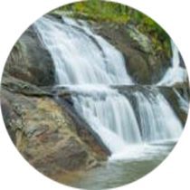
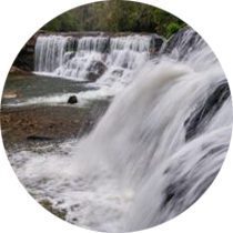
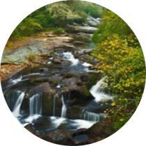
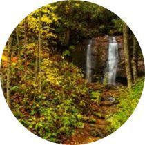
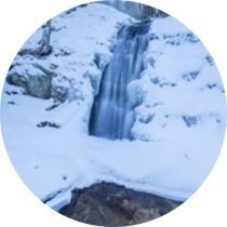
North Carolina is home to thousands of waterfalls. While many can only be reached by strenuous hikes, there are numerous waterfalls that can be accessed by anyone, regardless of ability, age, or income level.
This page features dozens of waterfalls from across the state that most people can visit. A few of them require short walks that aren’t suitable for wheelchairs, but most of them are very close to the road or have wheelchair-accessible views. You don’t even need to get out of your car to see some of them!


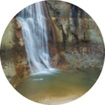
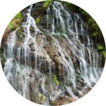
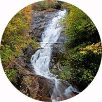
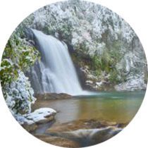
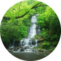
Big Creek Falls
View roadside. Near Burnsville.
County: Yancey
Driving directions:
About 5 miles west of Burnsville on US 19E, turn north on US 19W and drive 17.8 miles to the waterfall, on the left. A small pullout is located right at the falls.
Walking directions:
You can see the waterfall from the road. Or you can climb down the bank a short distance for an up-close view.
Bridal Veil Falls
View roadside. Near Highlands.
County: Macon
Driving directions:
From NC 106 in Highlands, drive 2.3 miles west on US 64. You can’t miss it! This waterfall is right beside the road. In fact, the road once ran behind it!
Bullpen Cove Falls
View roadside. Near Canton.
County: Haywood
Driving directions:
The waterfall is located on the south (left) side of US 276, some 2.2 miles north of the Blue Ridge Parkway. There is no parking at the waterfall, though you might be able to squeeze a compact car on the river-left side. The better plan is to find a safe place to pull over north or south of the falls and carefully walk the road.
Clark Park Falls
Short, level walk. In Fayetteville.
County: Cumberland
Driving directions:
The park is located at 631 Sherman Drive in Fayetteville. From the junction of US 401 and US 401 Business, go about 1.3 miles south on US 401B and turn left on Sherman Drive. Follow the road 0.4 mile to the park entrance, then continue 0.1 mile to the large gravel parking area. The park is open Monday through Saturday from 8 to 5.
Walking directions:
From the far end of the parking lot, take the paved path that crosses the railroad track. In a short distance, the path forks. Go left and follow the path to the nature center. Go around the right side of the center to the viewing deck for the falls.
The waterfall is surprisingly high for eastern NC. Best to visit after a heavy rain and when the leaves are off the trees.
Cliff Branch Falls
View roadside. Great Smoky Mountains National Park.
County: Swain
Driving directions:
Located right beside Newfound Gap Road in Great Smoky Mountains National Park, this small waterfall is a popular stop for tourists. It’s on the left side of the road 3.35 miles north of the entrance to Smokemont Campground. About 18 feet high and on a small stream, it’s usually not remarkable. But if you catch it right after a heavy rain, it’s certainly worth a look.
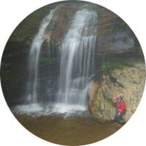
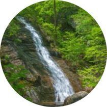
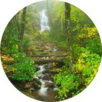
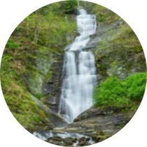
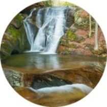
Connestee Falls
Short flat walk. Near Brevard.
County: Transylvania
Driving directions:
Drive 5.8 miles south from downtown Brevard on US 276 and turn right into the paved parking area. Look for the Connestee Falls Park sign.
Walking directions:
A short, wheelchair-accessible path leads from the parking area to a viewing deck at the top of the falls.
The photo shows the waterfall from the base, which is inaccessible. The viewing deck overlooks to top of the falls.
Cullasaja Falls
Roadside view. Near Franklin.
County: Macon
Driving directions:
From NC 106 in Highlands, drive 8.75 miles west on US 64 to the pullout on the left. You can view the falls from the road, but there is little room to pull over. Also, it’s extremely dangerous to do so if you’re driving west because you have to cross traffic on a sharp curve. It’s much safer to drive past the falls, turn around about 0.5 mile down the road, drive back, and then pull off.
Dry Falls
Accessible viewing deck at the parking area. Near Highlands.
County: Macon
Driving directions:
From NC 106 in Highlands, drive 3.15 miles west on US 64 to the parking area on the left.
Walking directions:
A handicapped-accessible boardwalk leads from the parking area to a viewpoint for the falls. For those who can handle the steps, an obvious paved path leads from the lower end of the parking area down to the falls.
Duggers Falls
Short, easy hike. Near Linville Falls.
County: Burke
Driving directions:
From Milepost 316.5 of the Blue Ridge Parkway (1 mile north of the US 221 intersection), a spur road leads 1.4 miles to a large parking area and a small visitor center. This is also the trailhead for Linville Falls, a beautiful waterfall that isn’t accessible for persons with mobility issues.
Walking directions:
Walk to the upper end of the parking area, away from the visitor center. With your back to the visitor center, look to the right for a concrete cylinder about four feet high and five feet in diameter. An obvious paved path goes to the right and ascends a few feet to a side path on the left. The side path leads a short distance to a footbridge over Duggers Creek just below the falls. You can make a loop by continuing on the path, but the remainder of the loop is more difficult.
Glassmine Falls
View from Blue Ridge Parkway overlook. Near Craggy Gardens, north of Asheville.
County: Buncombe
Driving directions:
Glassmine Falls Overlook is located at Milepost 361.3 of the Blue Ridge Parkway, a few miles north of Craggy Gardens.
Walking directions:
From the overlook, you can view this high waterfall across the gorge. During periods of low flow, it can dry up.
Green Mountain Falls
View roadside. Near Blowing Rock.
County: Watauga
Driving directions:
From the junction of US 221 and Blue Ridge Parkway near Grandfather Mountain, drive north on US 221 for 7.25 miles. From Blowing Rock, drive 7.9 miles south on US 221.
Jagged Rock Falls
View Roadside. Near Nantahala Gorge.
County: Swain
Driving directions:
Directly across Wayah Road from Old River Road (see Whiteoak Falls) is a 40-foot waterfall that is impressive after a good rain but not worth stopping for in dry weather. The rock here is jagged, just like that at Whiteoak Falls. The countless mini-ledges break the flow of the waterfall, creating a great opportunity for photographing tight compositions.
Katies Falls
View roadside. Near Franklin.
County: Macon
Driving directions:
From the junction of US 441, NC 28, and US 64 in Franklin, head east on US 64/NC 28 for 3 miles and turn left on Ellijay Road (SR 1001). Drive 5.25 miles to the falls, on the left.
Katies Falls is best viewed after a good rain.
Key Falls
View roadside. Near Brevard.
County: Transylvania
Driving directions:
From the junction of US 64, US 276, and NC 280 in Brevard, drive 3.5 miles east on US 64 and turn right on Crab Creek Road (SR 1528). After about 1.5 miles, turn right on Everett Road (SR 1533). It is 2.75 miles to the driveway for Key Falls Inn, on the left. You can park at the inn and walk a short distance along a path to the falls. If you don’t want to walk, you can turn onto the gravel road just before the entrance to the inn and drive 0.2 mile to the falls. The road is private, but the land surrounding the falls is part of the inn property, so you can drive as far as the falls.
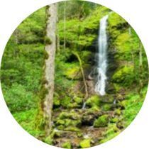
Little Fall Branch Falls
Quarter-mile easy hike. Near Waynesville.
County: Haywood
Driving directions:
Take the Harmon Den exit (Exit 7) off I-40 and head north on the gravel Cold Springs Creek Road (FR 148). At 3.7 miles is a sign for Cold Springs Picnic Area and Harmon Den Horse Camp. Turn right here onto FR 3526 and follow it to the gate at 0.35 mile. Park on the side of the road without blocking the gate.
Walking directions:
Two streams that are close together cross FR 3526 between the entrance to the horse camp and the gate where you parked. The first one is Fall Branch. The second, which crosses right at the gate, is Little Fall Branch. That’s the one you want to follow upstream. Walk about 20 feet beyond the gate and take the obvious path on the left.
Little Wildcat Falls
County: Haywood
Driving directions:
From the Blue Ridge Parkway, drive 1.6 miles north on NC 215 to this small waterfall on the west side of the road. A pullout is on the east side of the road just before the falls. The waterfall is right beside the road. But to see it well, you’ll have to get out of the car and walk up to it. The waterfall is 16.3 miles south of US 276.
Log Hollow Falls
Easy 0.5-mile hike. Near Brevard.
County: Transylvania
Driving directions:
From the junction of US 64, US 276, and NC 280 in Brevard, drive north on US 276 for 10.3 miles (passing Looking Glass Falls on the way) to the unpaved FR 475B (Headwaters Road), on the left. From the Blue Ridge Parkway, it is 4.7 miles to this point. Drive 1.6 miles on FR 475B to a sharp left-hand curve. Park on the outside of the curve at the forest management interpretive sign. FR 475B continues 4.9 miles to FR 475 near the Pisgah Center for Wildlife Education.
Walking directions:
A gated logging road (FR 5043) starts from the outside of the curve. Hike this road to the second bridge. The waterfall is about 100 feet upstream. A path on the other side of the bridge leads to the base.
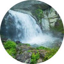
Looking Glass Falls
County: Transylvania
Driving directions:
From the junction of US 64, US 276, and NC 280 in Brevard, drive north on US 276 for 5.65 miles to the long, narrow parking area on the right. From the Blue Ridge Parkway, it is 9.35 miles to the falls.
Walking directions:
You can view the waterfall from an overlook on the upper end of the parking area or descend the steps to the base. Looking Glass Falls is one of the more popular waterfalls in the state, so expect crowds!
McGalliard Falls
Short, easy walk to viewing area. Near Valdese.
County: Burke
Driving directions:
The waterfall is in McGalliard Falls Park, administered by the Valdese Recreation Department. To reach it, take Exit 111 off I-40 and drive 1.1 miles on Carolina Street to Main Street in Valdese. Turn left and go 0.5 mile to Church Street, on the right. It is 1.4 miles on Church Street to the park, on the right. The park is open daily from 8 a.m. until dark. The restrooms are open April to October.
Walking directions:
An observation overlook is behind the picnic shelter. You can walk around to the mill on the other side and climb down to the base.
Mill Shoals Falls
Short, mostly easy walk. Balsam Grove community.
County: Transylvania
Driving directions:
From Beech Gap on the Blue Ridge Parkway, head south on NC 215 for 9.35 miles. Park on the narrow shoulder on the right (west) side of the road just south of Living Waters Ministry. This is 7.7 miles north of US 64.
Walking directions:
The waterfall sits behind the house and is partly visible from the road. You can take the short path down to the base. Bird Rock Falls is about 0.2 miles downstream, but there are a few steps and a steeply sloping rock to negotiate to see it.
Moravian Falls
View roadside. Near Wilkesboro.
County: Wilkes
Driving directions:
From the junction of US 421 and NC 18/16 in Wilkesboro, head south on NC 18/16 for 3 miles and turn right on NC 18; NC 16 continues straight here. After 0.45 miles on NC 18, turn left on Falls Road (SR 1108) and proceed 0.5 miles to a view of the waterfall on the left.
Walking directions:
This 45-foot waterfall is on private property but is easily viewed from the road.
Nana Falls
View roadside. Near Jefferson.
County: Ashe
Driving directions:
From the junction of NC 16 and NC 88 a few miles west of Jefferson, drive 0.6 mile west (toward Jefferson) on NC 16/88 and turn left on Cox Road (SR 1156). The road changes to gravel at about 1.3 miles. At 1.55 miles, you’ll come to the waterfall, on the right.
Walking directions:
This small but scenic waterfall is right beside the road, across from New River.
Potholes Falls
Roadside view. Near Highlands.
County: Macon
Driving directions:
From US 64 in Highlands, head east on Horse Cove Road (Main Street) and descend into Horse Cove. Horse Cove Road ends at 4.55 miles where Whiteside Cove Road (SR 1606) turns left and Bull Pen Road (FR 1178) goes straight. Go straight on the unpaved Bull Pen Road. At 3 miles, you’ll come to a bridge over the Chattooga River. Park on the left before crossing the bridge. If there isn’t room, you’ll have to turn around and go back up the hill to the wide spot and park there. Parking is not allowed along the side of the road near the bridge. Potholes Falls is directly under the bridge.
Pounding Mill Falls
View roadside. Near Rosman.
County: Transylvania
Driving directions:
From the junction of US 178 and US 64 west of Brevard, drive south on US 178. At 4.9 miles to see this small waterfall. Look for an electrical transformer box at a telephone pole on the left (east) side of the road. The waterfall is a few yards ahead on the opposite (right) side of the road just before Babb Road (SR 1141). A small pullout is directly in front of the falls.
Quarry Falls
Roadside view. Near Highlands.
County: Macon
Driving directions:
From NC 106 in Highlands, drive 6.35 miles west on US 64 to the pullout on the left.
Shacktown Falls
View from parking or short walk. Near Yadkinville.
County: Yadkin
Driving directions:
From US 421 some 4 miles east of US 601 in Yadkinville, take the Shacktown exit (Exit 253) and turn north on Old Stage Road (SR 1733). Drive 0.2 mile to the T intersection, turn left, go 0.3 mile, then turn right on Styers Mill Road (SR 1646). Drive 0.5 mile to the gravel parking area on the left just before the road crosses the creek.
Walking directions:
You can easily see this scenic waterfall from the parking area, or you can take the short path down to the base for an up-close view.
Shunkawauken Falls
View roadside. Near Columbus.
County: Polk
Driving directions:
Take Exit 67 off I-26 and drive into Columbus on NC 108. After 0.5 mile, turn left on Houston Road (SR 1137). Go 0.5 mile and turn right to remain on Houston Road. Continue north for 0.5 mile, then turn left on White Oak Mountain Road (SR 1136). It is 2 miles to where the road crosses the creek right below the waterfall. There is a small pullout on the left, just before the falls.
Silver Run Falls
Short, easy walk with root scrambling. Near Cashiers.
County: Jackson
Driving directions:
From US 64 in Cashiers, drive south on NC 107 for 4.05 miles and park in the pullout on the left.
Walking directions:
An obvious path starts beside the American holly tree at the lower end of the pullout. The path goes about 500 feet to a footbridge over the Whitewater River. From there, it’s a short distance to the base of the falls. The path is short, but you’ll have to climb over some roots and get out on the rock to view the falls.
Silvervale Falls
View roadside. Near Blowing Rock and Lenoir.
County: Caldwell
Driving directions:
From the junction of US 321 Business and US 321 south of Blowing Rock, drive south on US 321 for 6.7 miles and turn right on Waterfalls Road (SR 1371). It is 1.75 miles to the falls, located on the left. Waterfalls Road continues 1 mile to Kirby Mountain Road, where a left turn leads back to US 321.
Soco Falls
Short, relatively easy walk to the viewing deck. Near Cherokee.
County: Jackson
Driving directions:
From where US 19 runs under the Blue Ridge Parkway at Soco Gap, drive north on US 19 toward Cherokee. A pullout is on the left 1.5 miles from the parkway. Park here.
Walking directions:
A short path leads down to a viewing deck. It’s easy except for a few steps.
Sunburst Falls
View roadside. Near Canton.
County: Haywood
Driving directions:
From the junction of NC 215 and the Blue Ridge Parkway at Beech Gap, drive north on NC 215 for 4.3 miles to where the road crosses the river on a high bridge. A small pullout is on the left just beyond the bridge. The bridge is 13.6 miles south of US 276.
The road literally passes over the middle of Sunburst Falls. You can easily view the upper section from the bridge.
Tom Branch Falls
Quarter-mile level walk. Great Smoky Mountains National Park.
County: Swain
Driving directions:
From downtown Bryson City, turn off Main Street (US 19) onto Everett Street. Drive 0.2 miles and turn right on Depot Street just after crossing the railroad tracks. Go less than 0.2 miles and turn left on Ramsey Street, which becomes Deep Creek Road, and enter the park at about 2.2 miles. Continue 0.6 miles to the large parking lot at the end of the road.
Walking directions:
The trail, a continuation of the paved road, turns to gravel beyond the turnaround. If you’re hiking in summer, pay close attention because you’ll walk right by the waterfall if the sign is missing. Look for a little clearing at a large oak tree beside Deep Creek. The waterfall drops into Deep Creek from the opposite mountainside.
The trail is only a quarter mile and very easy. In spring or winter, the waterfall is very nice, but with low flow and summer foliage, it’s not all that impressive.
Toms Creek Falls
Fairly easy 0.4-mile hike. Near Marion.
County: McDowell
Driving directions:
From the junction of US 221 and US 70 northwest of Marion, drive north on US 221 for 5.65 miles and turn left on Huskins Branch Road (SR 1440). Follow this road 1.2 miles to a small parking area on the right bordered by an old rail fence.
Walking directions:
The trail starts at the upper end of the parking area at the kiosk. It’s wide, well graded, and easily followed all the way to the viewing deck below the falls. Just before the deck, a path on the right leads up to a viewpoint on a rock. The waterfall is very high and scenic.
Toxaway Falls
View roadside. At Lake Toxaway.
County: Transylvania
Driving directions:
Toxaway Falls lies immediately below the US 64/NC 281 bridge over the river. The bridge is 0.4 miles west of where NC 281 turns off north and 2.2 miles east of where it turns off south. A pullout is on the east side of the bridge. There is a walkway on the west side of the bridge for viewing the falls. Exercise caution on this busy road.
Trillium Falls
View roadside. Not near anything!
County: Madison
Driving directions:
From the junction of US 25/70 and NC 208 northeast of Hot Springs, head north on NC 208 for 3.45 miles and turn right on NC 212. Drive 12.55 miles and turn right on the unpaved Sugar Loaf Mountain Road. A sign here calls this a private road, but it appears to be open to the public for providing access to FR 275. The road forks at 0.3 mile. Go right. At 0.75 mile, you’ll reach the falls, on the left.
Walking directions:
The waterfall is on private property but you can see it easily from the road.
Upper Cascade Falls
Easy 0.4-mile hike. Hanging Rock State Park.
County: Stokes
Driving directions:
From the town of Danbury, drive west on NC 8/89 for 1.5 miles and turn left on Hanging Rock Park Road (SR 2015) across from the hospital. Drive 1.5 miles to the park entrance, then continue another 1.75 miles to the large parking lot on the left in front of the visitor center.
Walking directions:
The trail begins at the upper end of the parking lot, near the entrance. After 160 feet, you’ll cross the main park road (the one you drove in on). Shortly afterward, the trail forks. Take the right (unpaved) fork and follow the trail along a dry ridge before swinging left toward the viewing deck.
Walker Falls
View roadside. Near Barnardsville.
County: Buncombe
Driving directions:
If you’re in the Asheville area, the best way to reach the falls is to drive to Barnardsville on NC 197, which turns west off US 19/23 a few miles north of Asheville. In “downtown” Barnardsville, turn south onto Dillingham Road (SR 2173). In 4.9 miles, the road changes to gravel and becomes FR 74. After 9.1 miles, you’ll reach Walker Falls, on the left. If you’re coming from the Blue Ridge Parkway, you can turn off the drive leading to Craggy Gardens Picnic Area onto FR 63, which will eventually bring you to Dillingham Road about 3.5 miles from NC 197. FR 63 may be gated in winter.
Walker Hollow Falls
View roadside. Near the community of Globe.
County: Caldwell
Driving directions:
You can access the waterfall from Blowing Rock using Globe Road, from US 221 using Edgemont Road, or from the south using NC 90. From the junction of Globe Road (SR 1367) and Anthony Creek Road (SR 1362) at Globe Baptist Church, drive north on Anthony Creek Road. The road changes to gravel after about 1.2 miles. At 3.1 miles, you’ll reach the falls, on the right.
Waterfall on Hungry River
View roadside. Near Hendersonville.
County: Henderson
Driving directions:
South of Hendersonville, take Exit 53 off I-26 onto Upward Road. Head east (away from Hendersonville) on Upward Road for 1.6 miles and turn right on Big Hungry Road (SR 1802). The road forks at 0.5 mile; stay left to remain on Big Hungry Road. Continue 0.25 mile to another fork and bear right. From this fork, drive 1.5 miles to a pullout on the left, just before the bridge over Hungry River. A larger pullout is on the right, a little bit before the bridge.
Walking directions:
You can easily view the waterfall from the bridge, or take the short and easy path up to the base.
Waterfalls Park Falls
View from parking area. In Newland.
County: Avery
Driving directions:
The town of Newland is located a few miles west of Grandfather Mountain at the junction of NC 181 and NC 194. On the right on NC 194 a little over 1 mile north of this junction is Waterfalls Park, on the right. It’s directly opposite the Dollar General store.
Walking directions:
You can view this small waterfall from the parking area and take the path that leads up to views of the upper sections.
Whiteoak Falls
View from the road. Near Nantahala Gorge.
County: Macon
Driving directions:
From Nantahala Outdoor Center, go 7.5 miles south on US 19/74, turn left on Wayah Road (SR 1310), and continue driving through Nantahala Gorge along the river. At 4.1 miles, turn right on Old River Road (FR 308). Drive less than 0.1 mile to the bridge over Whiteoak Creek and look upstream to see the falls. The view from the bridge is fair.
Whitewater Falls
Quarter-mile paved path. Near Cashiers.
County: Jackson
Driving directions:
From the junction of NC 281 and US 64 west of Lake Toxaway, drive south on NC 281 for 8.5 miles and turn left at the sign for Whitewater Falls. The road leads a short distance to a large parking area. A small fee is charged for parking.
Walking directions:
From the turnaround at the lower end of the parking area, a paved path leads to an upper overlook of the falls. Ignore the inaccurate sign that says it’s 0.5 mile to the falls. It’s actually less than 0.25 mile to the overlook. The path isn’t level, but it might be doable for strong-armed persons in wheelchairs.
Widows Creek Falls
Short, easy walk. Stone Mountain State Park.
County: Wilkes
Driving directions:
From US 21 north of Elkin, turn east on Traphill Road (SR 1002). This point is 7.8 miles north of where US 21 narrows from four lanes to two and 10.15 miles south of the Blue Ridge Parkway. If you’re heading south from the parkway, turn right on Traphill Road. Travel 4.3 miles and turn right on John P. Frank Parkway. Follow this road until it enters the park after 2.3 miles, then continue another about 4 miles to the bridge over Widows Creek. On the other side of the creek are pullouts on both sides of the road.
Walking directions:
From the pullout on the right (north) side of the road, take the obvious and short path that leads to the base of the falls. This easy path is suitable for those with limited mobility, but it’s not appropriate for wheelchairs.
